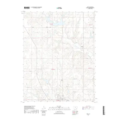
2018 Map of Sedan
USGS Topo · Published 2018About this map
The town of Sedan serves as the focal point of this Chautauqua County survey, situated at the confluence of several regional drainages including Middle Caney Creek and Deer Cr. The settlement pattern reflects a deeply rooted agricultural and rural landscape, where established family and community landmarks such as Union Chapel Cem and Greenwood Cem dot the countryside. The northern reaches are defined by a complex network of waterways, most notably North Caney Creek and Turkey Cr, which carved the undulating terrain long before the development of modern infrastructure like the Sedan City Airport.
Find a feature on this map
43 named features on this map. Tap any name to fly to it.
Don’t see what you’re looking for? This feature index may not catch every label — zoom into the map to look around manually.
Map Details
Editions of this 2018 Sedan Map
This is the sole edition of this map. No revisions or reprints were ever made.
Other maps of this area

1885 · Sedan
USGS Topo · 1:125,000

1889 · Sedan
USGS Topo · 1:125,000

1955 · Wichita
USGS Topo · 1:250,000

1958 · Wichita
USGS Topo · 1:250,000
1962 · Oak Valley
USGS Topo · 1:24,000

1962 · Moline
USGS Topo · 1:24,000
1962 · Elk Falls
USGS Topo · 1:24,000

1962 · Sedan
USGS Topo · 1:24,000

1962 · Elgin NE
USGS Topo · 1:24,000
1962 · Elgin
USGS Topo · 1:24,000