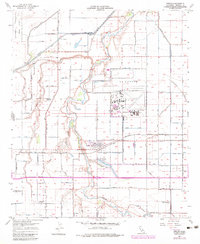
1957 Map of Seeley
USGS Topo · Published 1983About this map
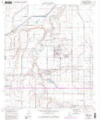
Seeley stands as the primary settlement in this irrigation-fed landscape of Imperial County, documented through surveys from the late 1950s and updated with late 1970s data. The extensive network of canals and drains, including Westside Drain and Fern Drain, illustrates the complex water management required for agriculture in this arid region. The presence of the Naval Air Facility and its runways highlights the area's mid-century military importance, while the San Diego and Arizona Eastern railroad tracks provide the primary industrial corridor through the desert. Local life is anchored by several rural schools, though the transition of the landscape is evident in the marking of the Silsbee School (Aban'd). Water features like Sunbeam Lake and the meandering New River contrast with the rigid grid of the surrounding desert fields and the specialized Recovery Test Range to the northwest.
Find a feature on this map
75 named features on this map. Tap any name to fly to it.
Don’t see what you’re looking for? This feature index may not catch every label — zoom into the map to look around manually.
Map Details
Editions of this 1957 Seeley Map
5 editions found
Other maps of this area

1915 · El Centro
USGS Topo · 1:125,000

1940 · Brawley
USGS Topo · 1:62,500

1940 · Heber
USGS Topo · 1:62,500

1940 · Plaster City
USGS Topo · 1:62,500

1940 · Coyote Wells
USGS Topo · 1:62,500

1942 · El Centro
USGS Topo · 1:250,000

1943 · Coyote Wells
USGS Topo · 1:62,500

1943 · Heber
USGS Topo · 1:62,500

1943 · Brawley
USGS Topo · 1:62,500

1944 · Plaster City
USGS Topo · 1:62,500