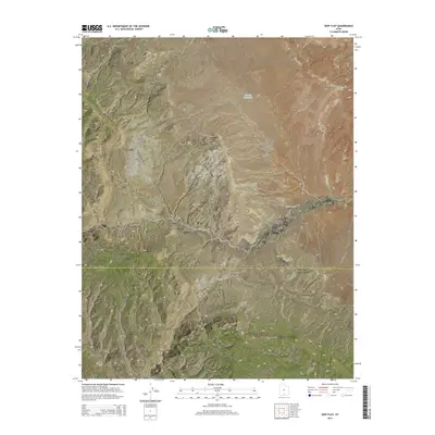
2014 Map of Seep Flat
USGS Topo · Published 2014About this map
Devils Garden Outstanding Natural Area defines the eastern portion of this high-desert landscape, where geologic features like Mano Arch and Metate Arch are preserved. The terrain is characterized by a dramatic change in elevation along the Straight Cliffs, which separate the higher plateau from the deep drainages of Right Hand Collet Canyon and Left Hand Collet Canyon. These canyons and the expansive Seep Flat illustrate the complex erosion patterns common across the Garfield County and Kane County boundary. The 2014 survey documents a largely undeveloped wilderness accessible via Missing Canyon Rd, with sparse water sources like Barney Reservoir and the drainage of Twentymile Wash serving as the few named hydrological landmarks in this arid environment.
Find a feature on this map
19 named features on this map. Tap any name to fly to it.
Don’t see what you’re looking for? This feature index may not catch every label — zoom into the map to look around manually.
Map Details
Editions of this 2014 Seep Flat Map
This is the sole edition of this map. No revisions or reprints were ever made.
Other maps of this area

1886 · Escalante
USGS Topo · 1:250,000

1922 · Upper Last Chance
USGS Topo · 1:63,360

1922 · Rees Canyon
USGS Topo · 1:63,360

1956 · Escalante
USGS Topo · 1:250,000

1960 · Escalante
USGS Topo · 1:250,000

1964 · Sunset Flat
USGS Topo · 1:24,000

1964 · Tenmile Flat
USGS Topo · 1:24,000

1964 · Dave Canyon
USGS Topo · 1:24,000

1964 · Seep Flat
USGS Topo · 1:24,000

1964 · Carcass Canyon
USGS Topo · 1:24,000