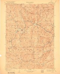
1922 Map of Seiad
USGS Topo · Published 1922About this map
The Klamath River carves a deep path through the Siskiyou Mountains in this early 20th-century survey of northern Siskiyou County. The landscape is defined by remote mining outposts and riverbank settlements, where gold and copper operations like the Blue Ledge Mine and Bunker Hill Mine drove the local economy. Small social centers are anchored by rural institutions such as the Seiad Valley School and the Indian Creek School.
Find a feature on this map
155 named features on this map. Tap any name to fly to it.
Don’t see what you’re looking for? This feature index may not catch every label — zoom into the map to look around manually.
Map Details
Editions of this 1922 Seiad Map
4 editions found

Other maps of this area

1886 · Shasta
USGS Topo · 1:250,000

1891 · Ashland
USGS Topo · 1:250,000

1893 · Ashland
USGS Topo · 1:250,000

1894 · Shasta
USGS Topo · 1:250,000

1897 · Ashland
USGS Topo · 1:250,000

1908 · Grants Pass
USGS Topo · 1:125,000

1914 · Seiad
USGS Topo · 1:125,000

1917 · Kerby
USGS Topo · 1:125,000

1918 · Kerby
USGS Topo · 1:125,000

1922 · Preston Peak
USGS Topo · 1:125,000