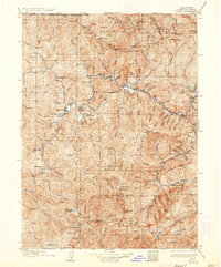
1922 Map of Seiad
USGS Topo · Published 1936About this map
The Klamath River carves a deep path through the Siskiyou Mountains in this early twentieth-century record of northern California. This survey identifies a network of mining operations and small settlements along the river's edge, reflecting the region's heavy reliance on gold extraction and ranching. The presence of Hughes Mine, Classic Hill Mine, and the Siskiyou Mines near Happy Camp highlights the persistent industrial activity in these canyons decades after the initial gold rush. Small social hubs are visible in the form of rural schools like the Lowden School and Nolton School, alongside family-run operations such as Johnsons Dairy. Transportation is largely dictated by the water, featuring points like Gordons Ferry, while the northern border is clearly defined by the California Oregon Boundary Line.
Find a feature on this map
96 named features on this map. Tap any name to fly to it.
Don’t see what you’re looking for? This feature index may not catch every label — zoom into the map to look around manually.
Map Details
Editions of this 1922 Seiad Map
4 editions found

Other maps of this area

1886 · Shasta
USGS Topo · 1:250,000

1891 · Ashland
USGS Topo · 1:250,000

1893 · Ashland
USGS Topo · 1:250,000

1894 · Shasta
USGS Topo · 1:250,000

1897 · Ashland
USGS Topo · 1:250,000

1908 · Grants Pass
USGS Topo · 1:125,000

1914 · Seiad
USGS Topo · 1:125,000

1917 · Kerby
USGS Topo · 1:125,000

1918 · Kerby
USGS Topo · 1:125,000

1922 · Preston Peak
USGS Topo · 1:125,000