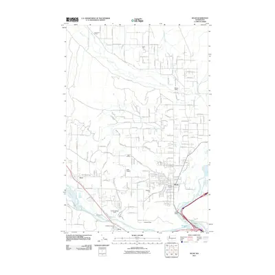
2011 Map of Selah
USGS Topo · Published 2011About this map
Selah serves as the industrial and residential hub of this 2011 survey, situated at the confluence of the Naches River and Yakima River. The landscape is defined by its complex irrigation and water management systems, including the Number 1 Lateral and Number 2 Lateral canals that support the agricultural economy of Wenas Valley and Lower Naches Valley. Social and civic life is anchored by landmarks like the Wenas Valley Grange and Lower Naches Grange, reflecting the region's enduring farming heritage.
Find a feature on this map
166 named features on this map. Tap any name to fly to it.
Don’t see what you’re looking for? This feature index may not catch every label — zoom into the map to look around manually.
Map Details
Editions of this 2011 Selah Map
This is the sole edition of this map. No revisions or reprints were ever made.
Other maps of this area

1899 · Ellensburg
USGS Topo · 1:125,000

1901 · Ellensburg
USGS Topo · 1:125,000

1936 · Yakima East
USGS Topo · 1:48,000

1938 · Badger Pocket
USGS Topo · 1:48,000

1941 · Yakima East
USGS Topo · 1:62,500

1943 · Badger Pocket
USGS Topo · 1:62,500

1950 · Yakima
USGS Topo · 1:250,000

1953 · Pomona
USGS Topo · 1:24,000

1953 · Yakima East
USGS Topo · 1:24,000
1953 · Wymer
USGS Topo · 1:24,000