
1951 Map of Selawik A-6
USGS Topo · Published 1967About this map
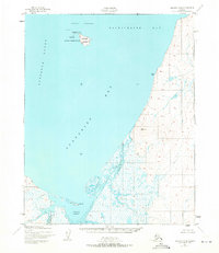
Chamisso National Wildlife Refuge anchors the northern waters of this coastal Alaska survey, protecting the rocky outcrops of Chamisso Island and Puffin Island within Chamisso Anchorage. The landscape is dominated by the tidal influence of Eschscholtz Bay and Spafarief Bay, where the shoreline meets the extensive marshlands and drainage of Kiwalik Lagoon. The settlement of Kiwalik sits at the mouth of the lagoon, serving as a remote outpost supported by a nearby airstrip. Inland, the terrain rises toward several peaks, including Church Rock, while a network of waterways like Kirk Creek, Minnehaha Creek, and Duck Creek meander through the tundra. The mapping, based on 1951 aerial photography by the Army Map Service, captures the region's mid-century coastal character before modern infrastructure changed the Arctic maritime landscape.
Find a feature on this map
15 named features on this map. Tap any name to fly to it.
Don’t see what you’re looking for? This feature index may not catch every label — zoom into the map to look around manually.
Map Details
Editions of this 1951 Selawik A-6 Map
2 editions found
Other maps of this area

1950 · Kotzebue A-1
USGS Topo · 1:63,360

1950 · Bendeleben
USGS Topo · 1:250,000

1950 · Bendeleben D-1
USGS Topo · 1:63,360

1951 · Candle
USGS Topo · 1:250,000

1951 · Selawik
USGS Topo · 1:250,000

1951 · Bendeleben
USGS Topo · 1:250,000

1951 · Kotzebue
USGS Topo · 1:250,000

1951 · Candle D-5
USGS Topo · 1:63,360

1951 · Selawik B-6
USGS Topo · 1:63,360

1951 · Selawik A-5
USGS Topo · 1:63,360