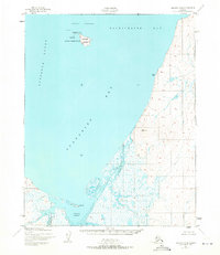
1951 Map of Selawik A-6
USGS Topo · Published 1971About this map
Chamisso National Wildlife Refuge anchors the northern waters of this coastal survey, encompassing both Chamisso Island and the smaller Puffin Island. The landscape is dominated by the tidal complexities of Kotzebue Sound, where the waters of Eschscholtz Bay and Spafarief Bay meet a coastline marked by low-lying marshes and the prominent Church Rock.
Find a feature on this map
16 named features on this map. Tap any name to fly to it.
Don’t see what you’re looking for? This feature index may not catch every label — zoom into the map to look around manually.
Map Details
Editions of this 1951 Selawik A-6 Map
2 editions found

Other maps of this area

1950 · Kotzebue A-1
USGS Topo · 1:63,360

1950 · Bendeleben
USGS Topo · 1:250,000

1950 · Bendeleben D-1
USGS Topo · 1:63,360

1951 · Candle
USGS Topo · 1:250,000

1951 · Selawik
USGS Topo · 1:250,000

1951 · Bendeleben
USGS Topo · 1:250,000

1951 · Kotzebue
USGS Topo · 1:250,000

1951 · Candle D-5
USGS Topo · 1:63,360

1951 · Selawik B-6
USGS Topo · 1:63,360

1951 · Selawik A-5
USGS Topo · 1:63,360