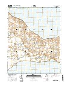
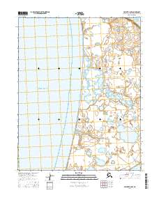
2016 Map of Selawik B-6 NE
USGS Topo · Published 2016About this map
The Baldwin Peninsula forms a narrow land bridge on this Arctic landscape, bounded by the waters of Hotham Inlet to the north and Eschscholtz Bay to the south. This coastal region in the Northwest Arctic Borough is defined by its low-lying maritime terrain, where the shifting shorelines of the Choris Peninsula meet the larger landmass. The map details the intricate hydrography of the peninsula's interior, showing numerous small lakes and ponds that characterize this subarctic environment. The lack of infrastructure or permanent settlements reflects the area's primary use for seasonal subsistence and its location within protected federal lands, including areas overseen by the FWS and BLM. For researchers, the topographical data provides a baseline for understanding coastal erosion and the complex drainage patterns of this remote northern peninsula.
Find a feature on this map
9 named features on this map. Tap any name to fly to it.
Don’t see what you’re looking for? This feature index may not catch every label — zoom into the map to look around manually.
Map Details
Editions of this 2016 Selawik B-6 NE Map
This is the sole edition of this map. No revisions or reprints were ever made.
Other maps of this area

1951 · Selawik
USGS Topo · 1:250,000

1951 · Selawik C-6
USGS Topo · 1:63,360

1951 · Selawik B-6
USGS Topo · 1:63,360

1951 · Selawik B-5
USGS Topo · 1:63,360

1955 · Selawik C-5
USGS Topo · 1:63,360

1957 · Selawik
USGS Topo · 1:250,000
2014 · Selawik B-6 SE
USGS Topo · 1:25,000
2016 · Selawik B-5 NW
USGS Topo · 1:25,000
2016 · Selawik B-6 SW
USGS Topo · 1:25,000
2016 · Selawik B-6 NW
USGS Topo · 1:25,000