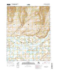
2015 Map of Selawik D-4 NE
USGS Topo · Published 2015About this map
The Kobuk River dominates this Arctic landscape as it meanders through a complex network of braids and bars within the Northwest Arctic Borough. To the northwest, the terrain rises into the Kiana Hills, where elevations surpass 1,000 feet, providing a stark contrast to the low-lying river basin. The hydrology of the area is further defined by the Oksik Channel and Oksik Creek, which snake through the southern portion of the quadrangle. This 2015 survey illustrates the characteristic braided river patterns of the region, where shifting channels and numerous small islands reflect the dynamic nature of the northern Alaskan interior. The map captures the intersection of high tundra and significant waterway corridors, highlighting the geographic features that have long shaped navigation and movement in this part of the state.
Find a feature on this map
12 named features on this map. Tap any name to fly to it.
Don’t see what you’re looking for? This feature index may not catch every label — zoom into the map to look around manually.
Map Details
Editions of this 2015 Selawik D-4 NE Map
This is the sole edition of this map. No revisions or reprints were ever made.
Other maps of this area

1951 · Baird Mountains
USGS Topo · 1:250,000

1951 · Selawik
USGS Topo · 1:250,000

1955 · Selawik D-4
USGS Topo · 1:63,360

1955 · Selawik D-3
USGS Topo · 1:63,360

1955 · Baird Mountains A-3
USGS Topo · 1:63,360

1955 · Baird Mountains A-4
USGS Topo · 1:63,360

1956 · Baird Mountains
USGS Topo · 1:250,000

1957 · Selawik
USGS Topo · 1:250,000

1965 · Baird Mountains
USGS Topo · 1:250,000
2015 · Baird Mountains A-4 SE
USGS Topo · 1:25,000