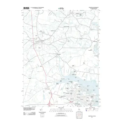
2011 Map of Selbyville
USGS Topo · Published 2011About this map
Selbyville and Ocean Pines anchor this detailed study of the Delaware-Maryland border region during the early twenty-first century. The landscape is defined by its complex hydrology, where Polly Branch and Carey Branch feed into a network of estuaries including the Saint Martin River and Teal Bay. This era shows significant residential development in communities like Bainbridge, Bay Colony, and Tanglewood, contrasting with the more established rural centers of Bishopville and Showell. For genealogists and local historians, the map preserves the locations of several burial grounds, including the Old Saint Martins Cemetery and Red Men Cemetery. The coastal influence is evident in the transition from inland agricultural drainage, such as White Oak Swamp Ditch, to tidal features like Jenkins Neck and Manklin Moorings. Local infrastructure is well-documented, featuring multiple postal locations like the Showell Post Office and community landmarks including Warrington Field.
Find a feature on this map
138 named features on this map. Tap any name to fly to it.
Don’t see what you’re looking for? This feature index may not catch every label — zoom into the map to look around manually.
Map Details
Editions of this 2011 Selbyville Map
This is the sole edition of this map. No revisions or reprints were ever made.
Other maps of this area

1901 · Ocean City
USGS Topo · 1:62,500

1902 · Pittsville
USGS Topo · 1:62,500

1917 · Millsboro
USGS Topo · 1:62,500

1918 · Rehoboth
USGS Topo · 1:62,500

1938 · Millsboro
USGS Topo · 1:62,500

1938 · Rehoboth
USGS Topo · 1:62,500

1942 · Ocean City
USGS Topo · 1:62,500

1942 · Ninepin
USGS Topo · 1:24,000

1942 · Ocean City
USGS Topo · 1:24,000

1942 · Whaleysville
USGS Topo · 1:24,000