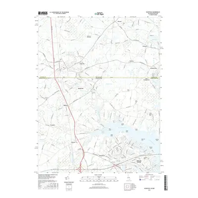
2016 Map of Selbyville
USGS Topo · Published 2016About this map
Ocean Pines and the surrounding coastal plains of the Delmarva Peninsula define this region along the Delaware Maryland border. The landscape is deeply etched by tidal tributaries of the Saint Martin River, including Bishopville Prong and Shingle Landing Prong. Established towns like Selbyville and Bishopville serve as inland anchors, while smaller communities such as Showell, Bishop, and Roxana are connected by a network of rural routes like Old Stage Rd and Bishopville Rd.
Find a feature on this map
78 named features on this map. Tap any name to fly to it.
Don’t see what you’re looking for? This feature index may not catch every label — zoom into the map to look around manually.
Map Details
Editions of this 2016 Selbyville Map
This is the sole edition of this map. No revisions or reprints were ever made.
Other maps of this area

1901 · Ocean City
USGS Topo · 1:62,500

1902 · Pittsville
USGS Topo · 1:62,500

1917 · Millsboro
USGS Topo · 1:62,500

1918 · Rehoboth
USGS Topo · 1:62,500

1938 · Millsboro
USGS Topo · 1:62,500

1938 · Rehoboth
USGS Topo · 1:62,500

1942 · Ocean City
USGS Topo · 1:62,500

1942 · Ninepin
USGS Topo · 1:24,000

1942 · Ocean City
USGS Topo · 1:24,000

1942 · Whaleysville
USGS Topo · 1:24,000