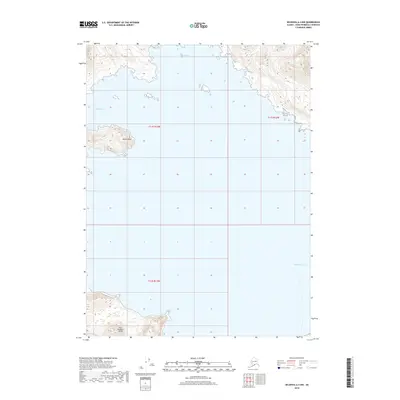
2018 Map of Seldovia A-4 NW
USGS Topo · Published 2018About this map
East Chugach Island anchors the southern portion of this coastal survey, where the terrestrial terrain of the Kenai Peninsula meets the open Pacific Ocean. This maritime landscape is defined by its deep inlets and isolated points of land, including the prominent Gomez Point and the sheltered waters of Windy Bay. Further north, Rocky Bay cuts into the shoreline, illustrating the complex coastal geomorphology of the region. The map provides a detailed topographic record of these landforms as they existed in the early twenty-first century, showing the elevation contours and natural drainage patterns that have historically shaped navigation and land use in this part of Alaska. While largely devoid of permanent settlements, the detailed mapping of named landmarks like these bays and points offers essential data for maritime history and environmental study.
Find a feature on this map
8 named features on this map. Tap any name to fly to it.
Don’t see what you’re looking for? This feature index may not catch every label — zoom into the map to look around manually.
Map Details
Editions of this 2018 Seldovia A-4 NW Map
This is the sole edition of this map. No revisions or reprints were ever made.
Other maps of this area

1951 · Seldovia
USGS Topo · 1:250,000

1951 · Seldovia B-5
USGS Topo · 1:63,360

1951 · Seldovia B-4
USGS Topo · 1:63,360

1951 · Seldovia A-4
USGS Topo · 1:63,360

1953 · Seldovia B-4
USGS Topo · 1:63,360

1953 · Seldovia A-5
USGS Topo · 1:63,360

1953 · Seldovia B-5
USGS Topo · 1:63,360
1953 · Seldovia A-4
USGS Topo · 1:63,360

1963 · Seldovia
USGS Topo · 1:250,000
1981 · Seldovia B-4
USGS Topo · 1:63,360