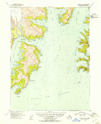
1953 Map of Seldovia B-2
USGS Topo · Published 1954About this map
Yalik Glacier dominates the northwest corner of this coastal survey, its ice mass feeding into the deep waters of Yalik Bay. The landscape is defined by the complex fjords and islands of the Kenai Peninsula, where the Nuka Passage separates the mainland from the prominent Nuka Island. Sparse human activity is evidenced only by small clusters of Cabins near Home Cove and a Cabin on the eastern shore of Nuka Island, suggesting a reliance on seasonal fishing or trapping in this maritime environment.
Find a feature on this map
33 named features on this map. Tap any name to fly to it.
Don’t see what you’re looking for? This feature index may not catch every label — zoom into the map to look around manually.
Map Details
Editions of this 1953 Seldovia B-2 Map
3 editions found
Other maps of this area

1951 · Seldovia
USGS Topo · 1:250,000

1951 · Seldovia A-3
USGS Topo · 1:63,360

1951 · Seldovia B-2
USGS Topo · 1:63,360

1951 · Seldovia B-3
USGS Topo · 1:63,360

1951 · Seldovia C-3
USGS Topo · 1:63,360

1952 · Seldovia A-3
USGS Topo · 1:63,360

1952 · Seldovia B-3
USGS Topo · 1:63,360

1953 · Seldovia C-3
USGS Topo · 1:63,360
1953 · Seldovia B-1
USGS Topo · 1:63,360

1953 · Seldovia B-2
USGS Topo · 1:63,360