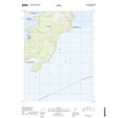
2017 Map of Seldovia B-2 SW
USGS Topo · Published 2017About this map
Nuka Island dominates the landscape of this coastal survey, where the rugged topography of the Kenai Fjords National Park meets the open waters of the Gulf of Alaska. The map illustrates a complex maritime environment protected by the Alaska Maritime National Wildlife Refuge, featuring a coastline indented by Mikes Bay and Berger Bay. The terrain rises sharply from the sea, with significant landmarks such as Cape Horn and Pinnacle Rock serving as prominent navigational markers. To the south, the island terminates at Nuka Point, near the isolated Nuka Rock. This survey provides a modern view of the Kenai Peninsula’s wilderness, documenting the intersection of federal conservation boundaries and the natural geomorphology of the Alaskan coastline before the Alaska Kenai Peninsula Borough border.
Find a feature on this map
13 named features on this map. Tap any name to fly to it.
Don’t see what you’re looking for? This feature index may not catch every label — zoom into the map to look around manually.
Map Details
Editions of this 2017 Seldovia B-2 SW Map
This is the sole edition of this map. No revisions or reprints were ever made.
Other maps of this area

1951 · Seldovia
USGS Topo · 1:250,000

1951 · Seldovia A-3
USGS Topo · 1:63,360

1951 · Seldovia B-2
USGS Topo · 1:63,360

1951 · Seldovia B-3
USGS Topo · 1:63,360

1952 · Seldovia A-3
USGS Topo · 1:63,360

1952 · Seldovia B-3
USGS Topo · 1:63,360

1953 · Seldovia B-2
USGS Topo · 1:63,360

1963 · Seldovia
USGS Topo · 1:250,000
2017 · Seldovia B-3 NE
USGS Topo · 1:25,000
2017 · Seldovia B-2 NE
USGS Topo · 1:25,000