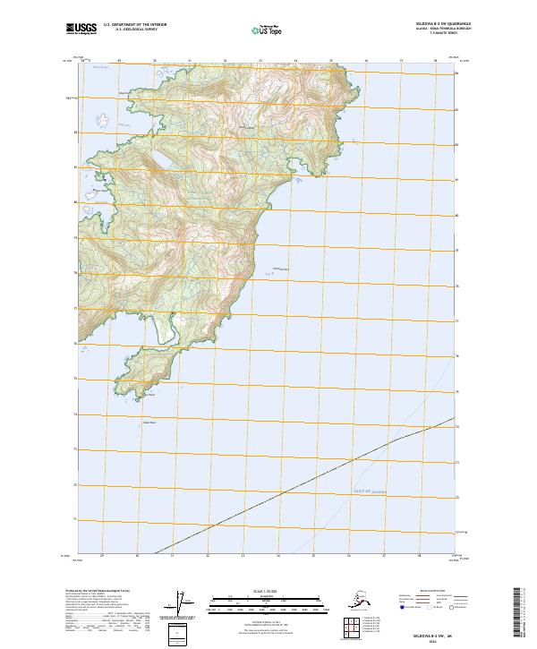
2024 Map of Seldovia B-2 SW
USGS Topo · Published 2024About this map
Nuka Island dominates this maritime landscape along the southern coast of the Kenai Peninsula, where the complex shoreline of Nuka Passage meets the open Gulf of Alaska. The island’s interior is defined by steep relief and conservation boundaries, split between the Kenai Fjords National Park and the Alaska Maritime National Wildlife Refuge. Numerous inlets and landforms provide navigational reference points for this uninhabited reach, from the sheltered waters of Mikes Bay and Westdahl Cove to the southern extremity at Nuka Point. Smaller landmasses like Berger Island and hazards such as Pinnacle Rock and Nuka Rock underscore the isolation of this wilderness area. The map illustrates a strictly natural topography where preservation is the primary human footprint, recorded by the U.S. Geological Survey and the Bureau of Land Management.
Find a feature on this map
17 named features on this map. Tap any name to fly to it.
Don’t see what you’re looking for? This feature index may not catch every label — zoom into the map to look around manually.
Map Details
Editions of this 2024 Seldovia B-2 SW Map
This is the sole edition of this map. No revisions or reprints were ever made.
Other maps of this area

1951 · Seldovia
USGS Topo · 1:250,000

1951 · Seldovia A-3
USGS Topo · 1:63,360

1951 · Seldovia B-2
USGS Topo · 1:63,360

1951 · Seldovia B-3
USGS Topo · 1:63,360

1952 · Seldovia A-3
USGS Topo · 1:63,360

1952 · Seldovia B-3
USGS Topo · 1:63,360

1953 · Seldovia B-2
USGS Topo · 1:63,360

1963 · Seldovia
USGS Topo · 1:250,000
2017 · Seldovia B-3 NE
USGS Topo · 1:25,000
2017 · Seldovia B-2 NE
USGS Topo · 1:25,000