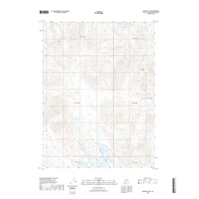
2018 Map of Seldovia B-4 SW
USGS Topo · Published 2018About this map
Rocky River and Windy River carve through the southern reaches of the Kenai Peninsula in this 2018 topographic study. The landscape is defined by its dramatic glacial and coastal features, where the freshwater system of Rocky Lake gives way to the saltwater inlets of Picnic Harbor and the broad opening of Rocky Bay. This survey captures the terrain as it appeared in the early 21st century, dominated by the prominent peak of Red Mtn and the drainage of Port Dick Cr. With no developed roads or settlements indicated, the map reveals a wilderness environment where the physical geography—from high mountain summits to protected harbors—remains the primary influence on the land.
Find a feature on this map
14 named features on this map. Tap any name to fly to it.
Don’t see what you’re looking for? This feature index may not catch every label — zoom into the map to look around manually.
Map Details
Editions of this 2018 Seldovia B-4 SW Map
This is the sole edition of this map. No revisions or reprints were ever made.
Other maps of this area

1951 · Seldovia
USGS Topo · 1:250,000

1951 · Seldovia B-5
USGS Topo · 1:63,360

1951 · Seldovia B-4
USGS Topo · 1:63,360

1951 · Seldovia A-4
USGS Topo · 1:63,360

1953 · Seldovia B-4
USGS Topo · 1:63,360

1953 · Seldovia A-5
USGS Topo · 1:63,360

1953 · Seldovia B-5
USGS Topo · 1:63,360
1953 · Seldovia A-4
USGS Topo · 1:63,360

1963 · Seldovia
USGS Topo · 1:250,000
1981 · Seldovia B-4
USGS Topo · 1:63,360