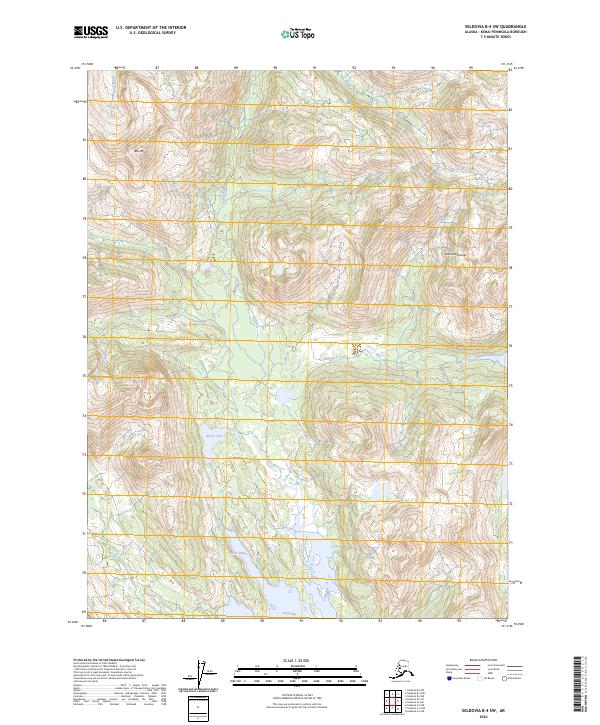
2024 Map of Seldovia B-4 SW
USGS Topo · Published 2024About this map
The coastal wilderness of the Kenai Peninsula is defined by a series of steep drainages and protected waters within the Alaska Maritime National Wildlife Refuge. High elevations are dominated by landmarks such as Red Mtn, which towers over the Windy River to the west. The landscape transitions from these alpine heights down to the complex coastline of the southern peninsula, where the Rocky River flows southward toward the sea. The map documents an area where the terrestrial environment meets the marine, centering on the sheltered waters of Picnic Harbor and the larger Rocky Bay. This region remains largely undeveloped, with no roads or settlements, reflecting its status as a critical habitat for migratory birds and marine mammals. The presence of Rocky Lake and Port Dick Creek further highlights the intricate freshwater systems that support the local ecosystem.
Find a feature on this map
15 named features on this map. Tap any name to fly to it.
Don’t see what you’re looking for? This feature index may not catch every label — zoom into the map to look around manually.
Map Details
Editions of this 2024 Seldovia B-4 SW Map
This is the sole edition of this map. No revisions or reprints were ever made.
Other maps of this area

1951 · Seldovia
USGS Topo · 1:250,000

1951 · Seldovia B-5
USGS Topo · 1:63,360

1951 · Seldovia B-4
USGS Topo · 1:63,360

1951 · Seldovia A-4
USGS Topo · 1:63,360

1953 · Seldovia B-4
USGS Topo · 1:63,360

1953 · Seldovia A-5
USGS Topo · 1:63,360

1953 · Seldovia B-5
USGS Topo · 1:63,360
1953 · Seldovia A-4
USGS Topo · 1:63,360

1963 · Seldovia
USGS Topo · 1:250,000
1981 · Seldovia B-4
USGS Topo · 1:63,360