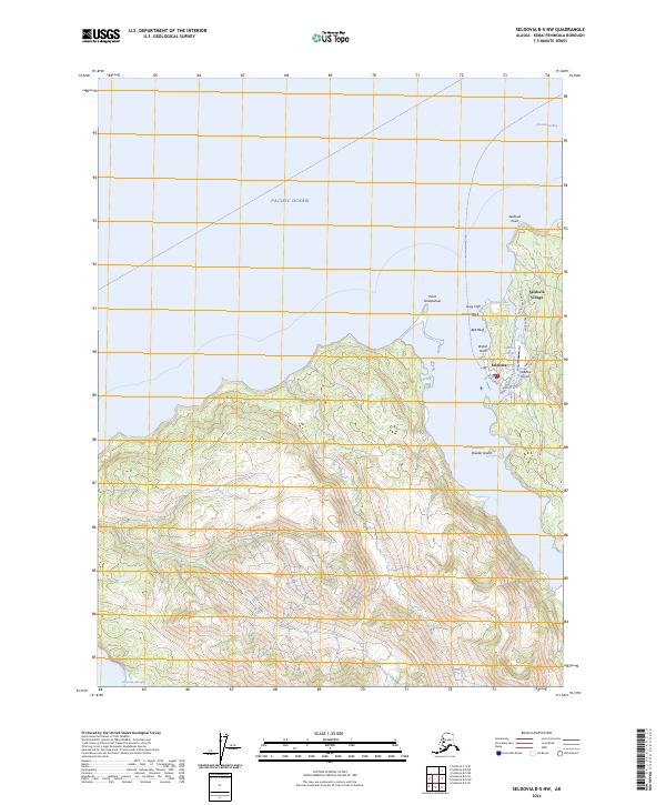
2024 Map of Seldovia B-5 NW
USGS Topo · Published 2024About this map
Seldovia and Seldovia Village stand as the primary centers of human activity along the southwestern edge of the Kenai Peninsula. This coastal landscape is defined by the complex interface of the Pacific Ocean and Kachemak Bay, where maritime life is protected within the Alaska Maritime National Wildlife Refuge. The local infrastructure is oriented toward the water and the sky, centered on the Seldovia Airport and a small network of roads including Jakalof Bay Road and Airport Avenue. Distinctive coastal landmarks like Point Naskowhak, Gray Cliff, and Camel Rock overlook the tidal reach of Seldovia Slough. This modern survey reveals the persistence of these small Alaskan communities, showing how they navigate the steep, forested terrain while remaining fundamentally tied to the inlets and points of Seldovia Bay.
Find a feature on this map
26 named features on this map. Tap any name to fly to it.
Don’t see what you’re looking for? This feature index may not catch every label — zoom into the map to look around manually.
Map Details
Editions of this 2024 Seldovia B-5 NW Map
This is the sole edition of this map. No revisions or reprints were ever made.
Other maps of this area

1946 · Seldovia C-5
USGS Topo · 1:63,360

1951 · Seldovia C-5
USGS Topo · 1:63,360

1951 · Seldovia
USGS Topo · 1:250,000

1951 · Seldovia B-5
USGS Topo · 1:63,360

1951 · Seldovia B-6
USGS Topo · 1:63,360

1953 · Seldovia B-6
USGS Topo · 1:63,360

1953 · Seldovia B-5
USGS Topo · 1:63,360

1961 · Seldovia C-5
USGS Topo · 1:63,360

1963 · Seldovia
USGS Topo · 1:250,000
1987 · Seldovia B-6 NE
USGS Topo · 1:25,000