
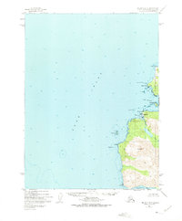
1951 Map of Seldovia B-6
USGS Topo · Published 1975About this map
English Bay serves as a central coastal settlement along the southwestern edge of the Kenai Peninsula, where the landscape transitions from the open waters of Cook Inlet to the high elevations of Mt Bede. This 1951 survey, with minor 1973 revisions, reveals an economy and geography tied closely to the shoreline, noted by the presence of a Coal Mine situated near Coal Cove. The map detail captures the maritime hazards of the era, labeling navigational challenges like Dangerous Cape Reef, Bird Reef, and the Flat Islands.
Find a feature on this map
21 named features on this map. Tap any name to fly to it.
Don’t see what you’re looking for? This feature index may not catch every label — zoom into the map to look around manually.
Map Details
Editions of this 1951 Seldovia B-6 Map
2 editions found
Other maps of this area

1946 · Seldovia C-5
USGS Topo · 1:63,360

1951 · Seldovia C-5
USGS Topo · 1:63,360

1951 · Seldovia
USGS Topo · 1:250,000

1951 · Seldovia B-5
USGS Topo · 1:63,360

1951 · Seldovia A-6
USGS Topo · 1:63,360

1952 · Seldovia A-6
USGS Topo · 1:63,360

1953 · Seldovia B-6
USGS Topo · 1:63,360

1953 · Seldovia A-5
USGS Topo · 1:63,360

1953 · Seldovia B-5
USGS Topo · 1:63,360

1961 · Seldovia C-5
USGS Topo · 1:63,360