1951 Map of Seldovia A-6
USGS Topo · Published 1975About this map
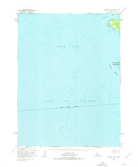
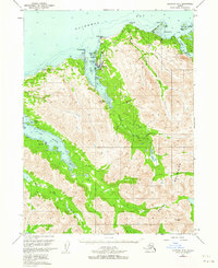
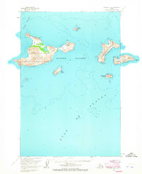
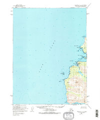
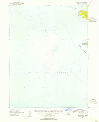
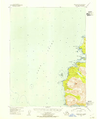
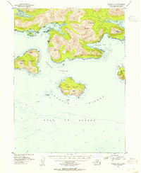
The waters of the Cook Inlet and the Gulf of Alaska meet at the southwestern tip of the Kenai Peninsula Borough in this maritime-focused survey. While the map is dominated by hydrographic soundings and deep-water contours, it captures the critical shoreline transition at the Chugach Islands, a significant landmark for Pacific coastal navigation. Photogrammetric data from 1951 details the rocky perimeter of Elizabeth Island and the prominent headland at Cape Elizabeth. This chart emphasizes the bathymetry and coastline of Koyuktolik Bay, documenting a remote maritime environment prior to modern nautical revisions, based on data compiled from early USC&GS charts to assist in understanding the treacherous coastal waters of the region.
Find a feature on this map
7 named features on this map. Tap any name to fly to it.
Don’t see what you’re looking for? This feature index may not catch every label — zoom into the map to look around manually.
Map Details
Editions of this 1951 Seldovia A-6 Map
2 editions found

Other maps of this area

1951 · Seldovia
USGS Topo · 1:250,000
1951 · Seldovia B-5
USGS Topo · 1:63,360
1951 · Afognak D-1
USGS Topo · 1:63,360
1951 · Seldovia B-6
USGS Topo · 1:63,360

1952 · Afognak
USGS Topo · 1:250,000
1952 · Seldovia A-6
USGS Topo · 1:63,360
1953 · Seldovia B-6
USGS Topo · 1:63,360
1953 · Seldovia A-5
USGS Topo · 1:63,360

1953 · Seldovia B-5
USGS Topo · 1:63,360

1963 · Seldovia
USGS Topo · 1:250,000