
1952 Map of Seldovia A-6
USGS Topo · Published 1955About this map
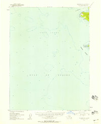
Cape Elizabeth and the rugged Chugach Islands mark the entrance to southern waters where the Cook Inlet meets the open Gulf of Alaska. This maritime survey, based on 1951 aerial photography and hydrography from nautical charts, provides a detailed look at the coastal interface of the Kenai Peninsula in the early 1950s. The map focuses heavily on the bathymetry and soundings of the inlet, showing depth contours and underwater hazards critical for navigation. Elizabeth Island sits prominently at the tip of the peninsula, while the sheltered waters of Koyuktolik Bay are visible to the northeast, offering a glimpse into the landform's relationship with the unpredictable northern seas before more modern coastal development took place.
Find a feature on this map
6 named features on this map. Tap any name to fly to it.
Don’t see what you’re looking for? This feature index may not catch every label — zoom into the map to look around manually.
Map Details
Editions of this 1952 Seldovia A-6 Map
2 editions found
Other maps of this area

1951 · Seldovia
USGS Topo · 1:250,000

1951 · Seldovia B-5
USGS Topo · 1:63,360
1951 · Afognak D-1
USGS Topo · 1:63,360

1951 · Seldovia A-6
USGS Topo · 1:63,360

1951 · Seldovia B-6
USGS Topo · 1:63,360

1952 · Afognak
USGS Topo · 1:250,000

1953 · Seldovia B-6
USGS Topo · 1:63,360

1953 · Seldovia A-5
USGS Topo · 1:63,360

1953 · Seldovia B-5
USGS Topo · 1:63,360

1963 · Seldovia
USGS Topo · 1:250,000