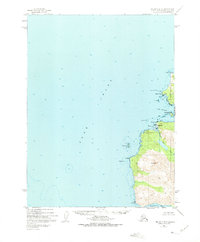
1951 Map of Seldovia B-6
USGS Topo · Published 1975About this map
Cook Inlet defines the western expanse of this 1950s survey, meeting the western edge of the Kenai Peninsula along a coast marked by navigational hazards and maritime industry. Near the entrance to Port Graham, a Coal Mine is situated at Coal Cove, reflecting the small-scale resource extraction that punctuated the early development of this region. The settlement of English Bay sits protected behind Russian Pt, serving as a focal point for local life near the mouth of the English Bay River.
Find a feature on this map
24 named features on this map. Tap any name to fly to it.
Don’t see what you’re looking for? This feature index may not catch every label — zoom into the map to look around manually.
Map Details
Editions of this 1951 Seldovia B-6 Map
2 editions found
Other maps of this area

1946 · Seldovia C-5
USGS Topo · 1:63,360

1951 · Seldovia C-5
USGS Topo · 1:63,360

1951 · Seldovia
USGS Topo · 1:250,000

1951 · Seldovia B-5
USGS Topo · 1:63,360

1951 · Seldovia A-6
USGS Topo · 1:63,360

1951 · Seldovia B-6
USGS Topo · 1:63,360

1952 · Seldovia A-6
USGS Topo · 1:63,360

1953 · Seldovia B-6
USGS Topo · 1:63,360

1953 · Seldovia A-5
USGS Topo · 1:63,360

1953 · Seldovia B-5
USGS Topo · 1:63,360