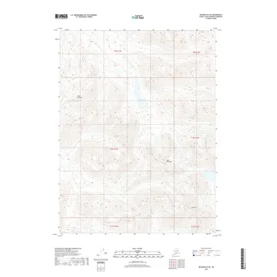
2018 Map of Seldovia B-5 SE
USGS Topo · Published 2018About this map
The Kenai Mountains dominate this high-elevation landscape on the Kenai Peninsula, where the terrain is defined by steep relief and glacial drainage patterns. Central to this survey is Seldovia Lake, a significant water body fed by the Seldovia River, which winds through the mountain valleys. The map provides a detailed topographic record of the wilderness just south of the Cook Inlet region, showing the natural corridors used for navigation through the southern Alaskan interior. High points such as Mt Mills anchor the southeastern corner of the quadrangle, illustrating the complex verticality of the coastal ranges. This 2018 record captures the region's hydrology and land elevation before significant modern shifts in the subarctic landscape.
Find a feature on this map
11 named features on this map. Tap any name to fly to it.
Don’t see what you’re looking for? This feature index may not catch every label — zoom into the map to look around manually.
Map Details
Editions of this 2018 Seldovia B-5 SE Map
This is the sole edition of this map. No revisions or reprints were ever made.
Other maps of this area

1951 · Seldovia
USGS Topo · 1:250,000

1951 · Seldovia B-5
USGS Topo · 1:63,360

1951 · Seldovia B-4
USGS Topo · 1:63,360

1951 · Seldovia A-4
USGS Topo · 1:63,360

1953 · Seldovia B-4
USGS Topo · 1:63,360

1953 · Seldovia A-5
USGS Topo · 1:63,360

1953 · Seldovia B-5
USGS Topo · 1:63,360
1953 · Seldovia A-4
USGS Topo · 1:63,360

1963 · Seldovia
USGS Topo · 1:250,000
1981 · Seldovia B-4
USGS Topo · 1:63,360