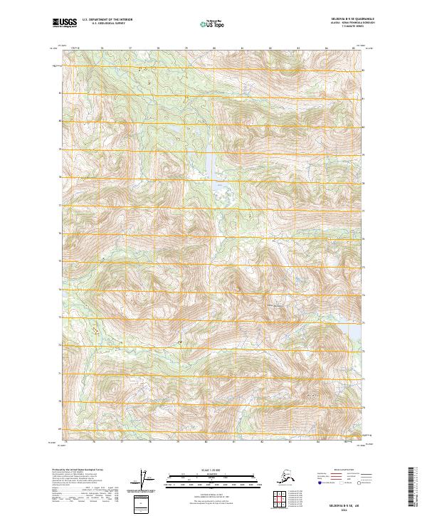
2024 Map of Seldovia B-5 SE
USGS Topo · Published 2024About this map
The Kenai Mountains dominate this high-elevation landscape on the Kenai Peninsula, where the terrain rises sharply from river valleys to prominent peaks like Mt Mills. This interior region is defined by its drainage systems, most notably the Seldovia River, which flows through the northern reaches of the map. Central to the geography is Seldovia Lake, a significant water body situated between steep ridges. The map illustrates a wilderness largely untouched by modern infrastructure, focusing instead on the complex contouring of the massif and the natural catchments that feed into the larger coastal inlets beyond the map's edge. Researchers will find a clear representation of the high country as it remains in the early 21st century, with detailed elevation data tracing the sharp divides and alpine basins of the southern peninsula.
Find a feature on this map
11 named features on this map. Tap any name to fly to it.
Don’t see what you’re looking for? This feature index may not catch every label — zoom into the map to look around manually.
Map Details
Editions of this 2024 Seldovia B-5 SE Map
This is the sole edition of this map. No revisions or reprints were ever made.
Other maps of this area

1951 · Seldovia
USGS Topo · 1:250,000

1951 · Seldovia B-5
USGS Topo · 1:63,360

1951 · Seldovia B-4
USGS Topo · 1:63,360

1951 · Seldovia A-4
USGS Topo · 1:63,360

1953 · Seldovia B-4
USGS Topo · 1:63,360

1953 · Seldovia A-5
USGS Topo · 1:63,360

1953 · Seldovia B-5
USGS Topo · 1:63,360
1953 · Seldovia A-4
USGS Topo · 1:63,360

1963 · Seldovia
USGS Topo · 1:250,000
1981 · Seldovia B-4
USGS Topo · 1:63,360