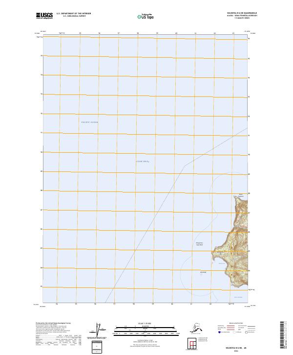
2024 Map of Seldovia B-6 NE
USGS Topo · Published 2024About this map
Port Graham marks the southeastern shoreline of this 2024 coastal survey, situated where the rugged Kenai Peninsula meets the waters of the Cook Inlet. The coastal landscape is defined by the extensive Alaska Maritime National Wildlife Refuge, which encompasses the dramatic headlands and offshore hazards that have historically challenged navigation in these waters. Maritime history is etched into the landscape at Dangerous Cape and the nearby Dangerous Cape Reef, while smaller inlets like Coal Cove suggest the area's geological and early resource potential.
Find a feature on this map
12 named features on this map. Tap any name to fly to it.
Don’t see what you’re looking for? This feature index may not catch every label — zoom into the map to look around manually.
Map Details
Editions of this 2024 Seldovia B-6 NE Map
This is the sole edition of this map. No revisions or reprints were ever made.
Other maps of this area

1946 · Seldovia C-5
USGS Topo · 1:63,360

1951 · Seldovia C-5
USGS Topo · 1:63,360

1951 · Seldovia
USGS Topo · 1:250,000

1951 · Seldovia B-5
USGS Topo · 1:63,360

1951 · Seldovia B-6
USGS Topo · 1:63,360

1953 · Seldovia B-6
USGS Topo · 1:63,360

1953 · Seldovia B-5
USGS Topo · 1:63,360

1961 · Seldovia C-5
USGS Topo · 1:63,360

1963 · Seldovia
USGS Topo · 1:250,000
1987 · Seldovia B-6 NE
USGS Topo · 1:25,000