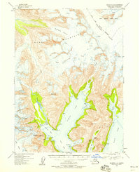
1953 Map of Seldovia C-2
USGS Topo · Published 1958About this map
The Kenai Mountains dominate this 1953 landscape, defined by a massive glacial system that includes the Kachemak Glacier, Dinglestadt Glacier, and Split Glacier. This coastal region of the Kenai Peninsula shows an intricate network of deep fjords, where the North Arm, West Arm, and East Arm carve into the mountain range. Small-scale maritime activity is suggested by the presence of a lone Cabin near James Lagoon and the sheltered waters of Pilot Harbor.
Find a feature on this map
40 named features on this map. Tap any name to fly to it.
Don’t see what you’re looking for? This feature index may not catch every label — zoom into the map to look around manually.
Map Details
Editions of this 1953 Seldovia C-2 Map
3 editions found

Other maps of this area

1950 · Seldovia D-2
USGS Topo · 1:63,360

1951 · Seldovia
USGS Topo · 1:250,000

1951 · Seldovia D-3
USGS Topo · 1:63,360

1951 · Seldovia B-2
USGS Topo · 1:63,360

1951 · Seldovia B-3
USGS Topo · 1:63,360

1951 · Seldovia C-3
USGS Topo · 1:63,360

1951 · Seldovia D-1
USGS Topo · 1:63,360

1952 · Seldovia B-3
USGS Topo · 1:63,360

1953 · Seldovia C-3
USGS Topo · 1:63,360
1953 · Seldovia B-1
USGS Topo · 1:63,360