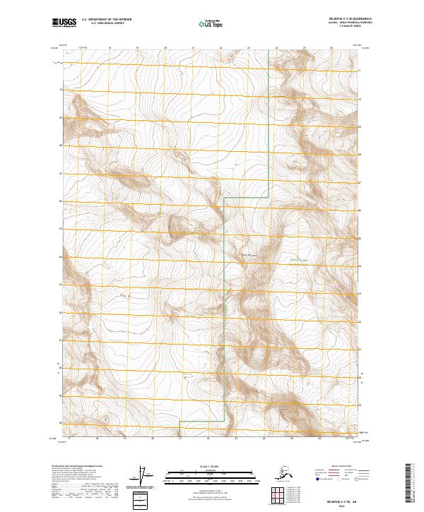
2024 Map of Seldovia C-3 SE
USGS Topo · Published 2024About this map
Iceworm Peak stands as a prominent landmark in this high-elevation region of the Kenai Mountains, where the boundaries of several major conservation units meet. The landscape is defined by the intersection of the Kenai National Wildlife Refuge, the Kenai Fjords National Park, and the Kenai Wilderness (Andrew Simons Unit). This 2024 survey captures a terrain dominated by sharp relief and glacial features rather than human settlement or infrastructure. The proximity of these administrative borders—including the t7s r9w and t7s r10w townships—illustrates the complex management of this subarctic wilderness. The absence of roads or established trails on the map underscores the primitive character of the Andrew Simons Unit, preserved as a contiguous habitat within the larger refuge system.
Find a feature on this map
11 named features on this map. Tap any name to fly to it.
Don’t see what you’re looking for? This feature index may not catch every label — zoom into the map to look around manually.
Map Details
Editions of this 2024 Seldovia C-3 SE Map
This is the sole edition of this map. No revisions or reprints were ever made.
Other maps of this area

1951 · Seldovia
USGS Topo · 1:250,000

1951 · Seldovia B-2
USGS Topo · 1:63,360

1951 · Seldovia B-3
USGS Topo · 1:63,360

1951 · Seldovia C-3
USGS Topo · 1:63,360

1952 · Seldovia B-3
USGS Topo · 1:63,360

1953 · Seldovia C-3
USGS Topo · 1:63,360

1953 · Seldovia B-2
USGS Topo · 1:63,360

1953 · Seldovia C-2
USGS Topo · 1:63,360

1963 · Seldovia
USGS Topo · 1:250,000
1987 · Seldovia C-3 NW
USGS Topo · 1:25,000