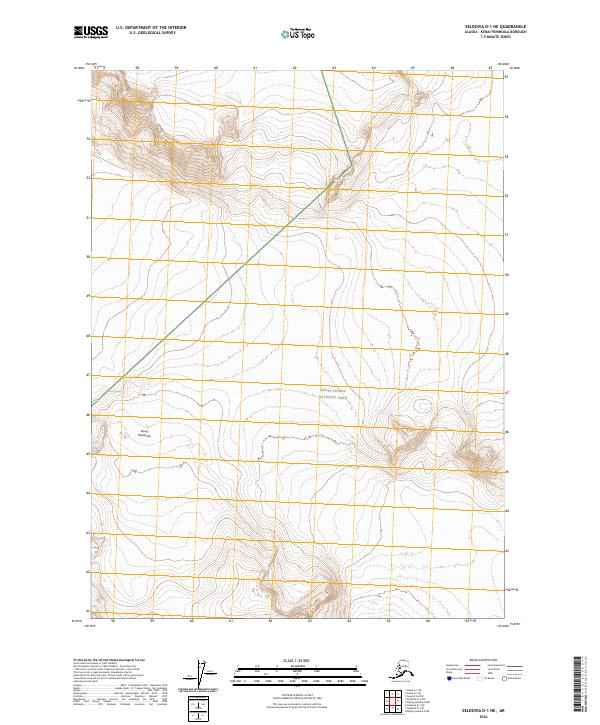
2024 Map of Seldovia D-1 NE
USGS Topo · Published 2024About this map
Kenai Peninsula dominates this landscape, showing a transition between several vast federally protected areas. The map details the intersection of the Kenai Wilderness (Andrew Simons Unit) and the Kenai National Wildlife Refuge in the north, while the southern reaches of the quadrangle are primarily occupied by Kenai Fjords National Park. This 2024 survey documents a rugged expanse of high-elevation terrain, defined by steep contour intervals and the administrative boundaries of these major Alaskan conservation units. The topography serves as a critical record of the glacial and mountainous character of the interior peninsula, where few human-made landmarks exist outside of the established public land survey system lines.
Find a feature on this map
8 named features on this map. Tap any name to fly to it.
Don’t see what you’re looking for? This feature index may not catch every label — zoom into the map to look around manually.
Map Details
Editions of this 2024 Seldovia D-1 NE Map
This is the sole edition of this map. No revisions or reprints were ever made.
Other maps of this area

1944 · Kenai
USGS Topo · 1:250,000

1946 · Blying Sound
USGS Topo · 1:250,000

1950 · Kenai
USGS Topo · 1:250,000

1950 · Seward A-8
USGS Topo · 1:63,360

1951 · Blying Sound
USGS Topo · 1:250,000

1951 · Seward
USGS Topo · 1:250,000

1951 · Seldovia
USGS Topo · 1:250,000

1951 · Kenai A-1
USGS Topo · 1:63,360
1951 · Blying Sound D-8
USGS Topo · 1:63,360

1951 · Seward A-8
USGS Topo · 1:63,360