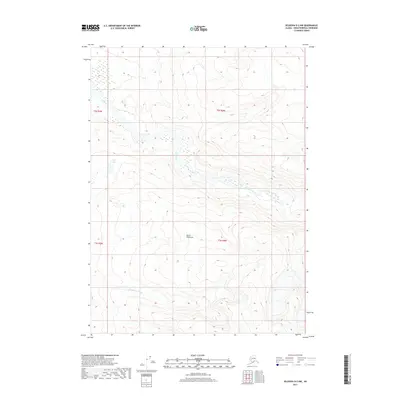
2017 Map of Seldovia D-2 NW
USGS Topo · Published 2017About this map
Kenai Peninsula terrain dominates this 2017 survey, where the wide alluvial valley of the Fox River creates a complex network of wetlands and shifting watercourses. The braided river system is complemented by Clearwater Slough and the isolated High Lake, illustrating the dynamic hydrology of this subarctic environment. While primarily an topographic study of natural landforms, the map provides precise section lines and township boundaries, including t2s r9w and t3s r8w, which are essential for identifying land tracts and historical property claims within this portion of the peninsula.
Find a feature on this map
8 named features on this map. Tap any name to fly to it.
Don’t see what you’re looking for? This feature index may not catch every label — zoom into the map to look around manually.
Map Details
Editions of this 2017 Seldovia D-2 NW Map
This is the sole edition of this map. No revisions or reprints were ever made.
Other maps of this area

1944 · Kenai
USGS Topo · 1:250,000

1950 · Kenai
USGS Topo · 1:250,000

1950 · Seldovia D-2
USGS Topo · 1:63,360

1951 · Seldovia
USGS Topo · 1:250,000

1951 · Seldovia D-3
USGS Topo · 1:63,360

1951 · Kenai A-3
USGS Topo · 1:63,360

1951 · Kenai A-2
USGS Topo · 1:63,360

1952 · Kenai A-2
USGS Topo · 1:63,360

1952 · Kenai A-3
USGS Topo · 1:63,360

1953 · Seldovia D-2
USGS Topo · 1:63,360