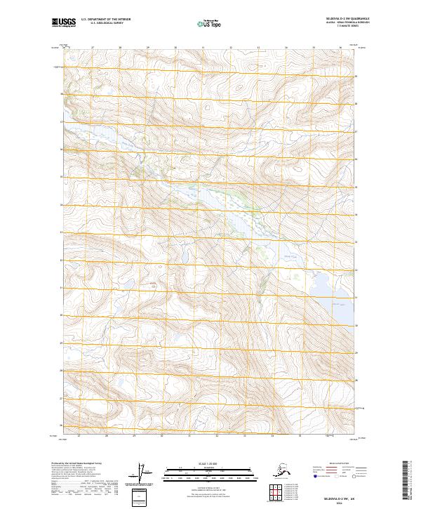
2024 Map of Seldovia D-2 SW
USGS Topo · Published 2024About this map
Kenai Wilderness and the Kenai National Wildlife Refuge dominate this section of the Kenai Peninsula, preserving a landscape of glacial hydrology and high-elevation terrain. The map captures the intricate drainage patterns of Sheep Creek as it winds through the wilderness area, illustrating the intersection of federally protected lands. In the southeastern portion of the quadrangle, Glacier Lake sits at the base of steep contours, serving as a primary landmark for the local topography. This document provides a precise account of the natural boundaries and water systems that define the Andrew Simons Unit, offering essential data for those studying the environmental geography and land management of this Alaska region.
Find a feature on this map
10 named features on this map. Tap any name to fly to it.
Don’t see what you’re looking for? This feature index may not catch every label — zoom into the map to look around manually.
Map Details
Editions of this 2024 Seldovia D-2 SW Map
This is the sole edition of this map. No revisions or reprints were ever made.
Other maps of this area

1950 · Seldovia D-2
USGS Topo · 1:63,360

1951 · Seldovia
USGS Topo · 1:250,000

1951 · Seldovia D-3
USGS Topo · 1:63,360

1951 · Seldovia C-3
USGS Topo · 1:63,360

1953 · Seldovia C-3
USGS Topo · 1:63,360

1953 · Seldovia C-2
USGS Topo · 1:63,360

1953 · Seldovia D-2
USGS Topo · 1:63,360
1953 · Seldovia D-3
USGS Topo · 1:63,360

1963 · Seldovia
USGS Topo · 1:250,000
2017 · Seldovia C-2 NE
USGS Topo · 1:25,000