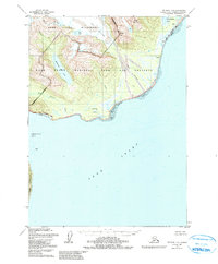
1958 Map of Seldovia D-8
USGS Topo · Published 1991About this map
The Iniskin Peninsula meets the sweeping waters of Cook Inlet in this coastal survey of the western Kenai Peninsula Borough. The landscape is defined by the reaching arm of East Glacier and the drainage of the Red River, which flows past Saddle Mountain into the inlet. Along the shoreline, specific maritime and industrial points appear, including a Sawmill near the Park and Preserve Boundary and a Cabin situated near Silver Salmon Lakes. This mid-century record documents a wilderness before extensive modern development, highlighting natural collection points like Clam Cove and Chinitna Bay. The interior is dotted with remote water bodies such as Hickerson Lake and Blue Lake, providing a clear look at the hydrologic patterns and topography of the Lake Clark National Park and Preserve area.
Find a feature on this map
26 named features on this map. Tap any name to fly to it.
Don’t see what you’re looking for? This feature index may not catch every label — zoom into the map to look around manually.
Map Details
Editions of this 1958 Seldovia D-8 Map
3 editions found
Other maps of this area

1944 · Kenai
USGS Topo · 1:250,000

1946 · Lake Clark
USGS Topo · 1:250,000

1949 · Iliamna C-1
USGS Topo · 1:63,360

1950 · Kenai
USGS Topo · 1:250,000

1951 · Lake Clark
USGS Topo · 1:250,000

1951 · Seldovia
USGS Topo · 1:250,000

1952 · Iliamna
USGS Topo · 1:250,000

1957 · Iliamna
USGS Topo · 1:250,000

1958 · Iliamna D-1
USGS Topo · 1:63,360

1958 · Iliamna C-1
USGS Topo · 1:63,360