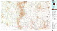
1994 Map of Sells
USGS Topo · Published 1994About this map
The Tohono O'odham Nation and the Papago Indian Reservation dominate the western half of this 1994 topographic survey, centered on the community of Sells. The landscape is defined by traditional settlements like Pisinimo, Ali Molina, and San Miguel situated along desert drainages such as Vamori Wash and Fresnal Wash. This area represents a complex cultural and political intersection, bordering the United States-Mexico border and the Arizona-Sonora state line.
Find a feature on this map
58 named features on this map. Tap any name to fly to it.
Don’t see what you’re looking for? This feature index may not catch every label — zoom into the map to look around manually.
Map Details
Editions of this 1994 Sells Map
2 editions found
Other maps of this area

1904 · Patagonia
USGS Topo · 1:125,000

1904 · Tucson
USGS Topo · 1:125,000

1905 · Patagonia
USGS Topo · 1:125,000

1905 · Tucson
USGS Topo · 1:125,000

1905 · Nogales
USGS Topo · 1:125,000

1920 · Arivaca
USGS Topo · 1:125,000

1921 · Old Glory
USGS Topo · 1:125,000

1922 · Agus Caliente
USGS Topo · 1:62,500

1925 · Samaniego Peak
USGS Topo · 1:62,500

1925 · San Xavier
USGS Topo · 1:62,500