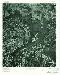
1975 Map of Selma SW
USGS Topo · Published 1977About this map
The Alabama River winds through the southeastern corner of this Dallas County landscape, carving a deep horseshoe bend that dominates the local topography. This 1975 orthophoto reveals a complex mosaic of land use, where heavily forested tracts alternate with cleared agricultural fields. The intricate drainage patterns and varying vegetation densities visible in the aerial imagery provide a clear look at the rural character of the region during the mid-1970s. Because this is an orthophotomap rather than a traditional line-and-symbol survey, it offers researchers a literal view of the ground cover and farmstead layouts near the river banks, preserving the exact state of the Alabama bottomlands at a specific moment in time.
Find a feature on this map
1 named feature on this map. Tap any name to fly to it.
Don’t see what you’re looking for? This feature index may not catch every label — zoom into the map to look around manually.
Map Details
Editions of this 1975 Selma SW Map
This is the sole edition of this map. No revisions or reprints were ever made.
Other maps of this area

1953 · Montgomery
USGS Topo · 1:250,000

1956 · Montgomery
USGS Topo · 1:250,000

1957 · Montgomery
USGS Topo · 1:250,000

1957 · Carlowville
USGS Topo · 1:62,500

1958 · Selma
USGS Topo · 1:62,500

1958 · Selma
USGS Topo · 1:24,000

1968 · Browns
USGS Topo · 1:24,000

1968 · Safford
USGS Topo · 1:24,000

1974 · Crumptonia
USGS Topo · 1:24,000

1975 · Selma NW
USGS Topo · 1:24,000