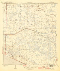
1944 Map of Seminole Hills
USGS Topo · Published 1944About this map
The Intracoastal Waterway cuts through a dense network of wetlands and swamps along the Panhandle coast, during a period of transition before the heavy development of the late 20th century. Surveyed by Lee Morrison and Chas. I. Hudson for the War Department and USGS, this map documents the sparsely populated border between Walton and Bay Counties. Small settlements like Laird, County Line Landing, and the seaside communities of Hollywood Beach and Sunnyside appear as fledgling hubs in a landscape dominated by water and terrain features like Doe Head Swamp, Marshall Swamp, and Powell Lake. The intricate drainage system is evidenced by numerous creeks and branches, including Tenmile Branch, Otter Creek, and Poley Branch, illustrating the area's natural state just after the second World War. For local historians, the placement of Phillips Inlet and the naming of smaller features like Dog Gap offer a precise view of the coastal geography before modern shoreline alterations.
Find a feature on this map
24 named features on this map. Tap any name to fly to it.
Don’t see what you’re looking for? This feature index may not catch every label — zoom into the map to look around manually.
Map Details
Editions of this 1944 Seminole Hills Map
4 editions found
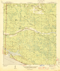
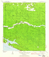
Other maps of this area

1936 · Point Washington
USGS Topo · 1:48,000

1939 · Point Washington
USGS Topo · 1:62,500

1943 · Laguna Beach
USGS Topo · 1:31,680

1943 · Panama City Beach
USGS Topo · 1:31,680

1943 · Seminole Hills
USGS Topo · 1:24,000

1943 · West Bay
USGS Topo · 1:24,000

1944 · Seminole Hills
USGS Topo · 1:31,680

1944 · West Bay
USGS Topo · 1:31,680

1944 · Bruce
USGS Topo · 1:24,000

1945 · Red Head
USGS Topo · 1:31,680