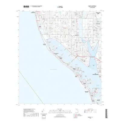
2018 Map of Seminole
USGS Topo · Published 2018About this map
The Intracoastal Waterway and a series of narrow barrier islands define the western edge of this coastal Pinellas County survey. The landscape transitions from the dense residential grid of Seminole and Pinellas Park to the gulf-front communities of Indian Rocks Beach, Redington Shores, and Madeira Beach. Significant inland water features like Lake Seminole and the Walsingham Reservoir dominate the interior, while the Cross Bayou Canal provides a critical hydrological link to the east.
Find a feature on this map
60 named features on this map. Tap any name to fly to it.
Don’t see what you’re looking for? This feature index may not catch every label — zoom into the map to look around manually.
Map Details
Editions of this 2018 Seminole Map
This is the sole edition of this map. No revisions or reprints were ever made.
Other maps of this area

1921 · Sand Key
USGS Topo · 1:62,500

1921 · Fort De Soto
USGS Topo · 1:62,500

1921 · St Petersburg
USGS Topo · 1:62,500

1943 · St Petersburg
USGS Topo · 1:31,680

1943 · Pass-A-Grille
USGS Topo · 1:31,680

1943 · Bay Pines
USGS Topo · 1:31,680

1943 · Safety Harbor
USGS Topo · 1:31,680

1943 · Clearwater
USGS Topo · 1:24,000

1947 · St Petersburg
USGS Topo · 1:25,000
1947 · Safety Harbor
USGS Topo · 1:24,000