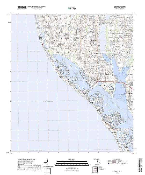
2025 Map of Seminole
USGS Topo · Published 2025About this map
Bay Pines National Cemetery serves as a prominent landmark on this coastal Pinellas County landscape, situated near Long Bayou and the developed residential corridors of Seminole. The geography is defined by a complex network of barrier islands and peninsulas, where Gulf Blvd connects a string of beach communities including Indian Shores, Redington Beach, and Madeira Beach. The Intracoastal Waterway and Boca Ciega Bay separate these coastal strips from the mainland, creating a distinct waterfront orientation for the entire region.
Find a feature on this map
61 named features on this map. Tap any name to fly to it.
Don’t see what you’re looking for? This feature index may not catch every label — zoom into the map to look around manually.
Map Details
Editions of this 2025 Seminole Map
This is the sole edition of this map. No revisions or reprints were ever made.
Other maps of this area

1921 · Sand Key
USGS Topo · 1:62,500

1921 · Fort De Soto
USGS Topo · 1:62,500

1921 · St Petersburg
USGS Topo · 1:62,500

1943 · St Petersburg
USGS Topo · 1:31,680

1943 · Pass-A-Grille
USGS Topo · 1:31,680

1943 · Bay Pines
USGS Topo · 1:31,680

1943 · Safety Harbor
USGS Topo · 1:31,680

1943 · Clearwater
USGS Topo · 1:24,000

1947 · St Petersburg
USGS Topo · 1:25,000
1947 · Safety Harbor
USGS Topo · 1:24,000