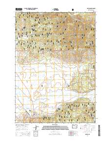
2014 Map of Seneca
USGS Topo · Published 2014About this map
The town of Seneca serves as a focal point in this high-desert landscape of Grant County, situated at the edge of Bear Valley. This 2014 survey captures the community's layout near the Seneca Emergency Airstrip and the John Day-Burns Hwy. The surrounding terrain is defined by the steep rises of the Aldrich Mountains and Starr Ridge to the north, which are deeply integrated into the Malhuer National Forest. A complex water management system is evident across the valley floor, featuring the Southworth Ditch and the Silvies River, along with irrigation and storage landmarks like Bull Run Reservoir and Rex Reservoir. For genealogists and local historians, the Southworth Cem stands as a significant point of interest west of the town center. The map reflects a landscape where timber and ranching history meet modern forest management, evidenced by the extensive network of National Forest Development roads like Logan Valley Ln.
Find a feature on this map
57 named features on this map. Tap any name to fly to it.
Don’t see what you’re looking for? This feature index may not catch every label — zoom into the map to look around manually.
Map Details
Editions of this 2014 Seneca Map
This is the sole edition of this map. No revisions or reprints were ever made.
Other maps of this area

1940 · Mount Vernon
USGS Topo · 1:62,500

1940 · John Day
USGS Topo · 1:62,500

1943 · John Day
USGS Topo · 1:62,500

1943 · Mount Vernon
USGS Topo · 1:62,500

1955 · Canyon City
USGS Topo · 1:250,000

1959 · Canyon City
USGS Topo · 1:250,000

1961 · Logdell
USGS Topo · 1:62,500

1961 · Seneca
USGS Topo · 1:62,500

1972 · Canyon Mtn
USGS Topo · 1:24,000
1972 · Fall Mountain
USGS Topo · 1:24,000