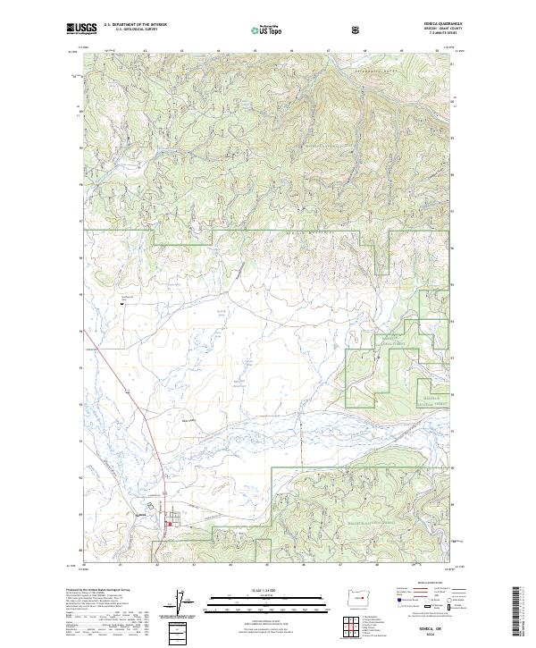
2024 Map of Seneca
USGS Topo · Published 2024About this map
Seneca serves as the primary hub of this high-elevation landscape, situated at the southern edge of Bear Valley. The town's grid is defined by Barnes Ave and 4th St, acting as a gateway to the expansive Malheur National Forest that dominates the surrounding terrain. The landscape is a complex network of hydrological features and mountain ridges, where the Silvies River and Bear Creek meander through the valley floor. To the north, the terrain rises sharply into the Strawberry Range and the Strawberry Mountain Wilderness, characterized by numerous spring-fed gulches like East Gulch and Sloan Gulch.
Find a feature on this map
52 named features on this map. Tap any name to fly to it.
Don’t see what you’re looking for? This feature index may not catch every label — zoom into the map to look around manually.
Map Details
Editions of this 2024 Seneca Map
This is the sole edition of this map. No revisions or reprints were ever made.
Other maps of this area

1940 · Mount Vernon
USGS Topo · 1:62,500

1940 · John Day
USGS Topo · 1:62,500

1943 · John Day
USGS Topo · 1:62,500

1943 · Mount Vernon
USGS Topo · 1:62,500

1955 · Canyon City
USGS Topo · 1:250,000

1959 · Canyon City
USGS Topo · 1:250,000

1961 · Logdell
USGS Topo · 1:62,500

1961 · Seneca
USGS Topo · 1:62,500

1972 · Canyon Mtn
USGS Topo · 1:24,000
1972 · Fall Mountain
USGS Topo · 1:24,000