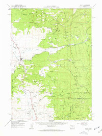
1961 Map of Seneca
USGS Topo · Published 1963About this map
Seneca serves as the primary hub of this high-desert timber and ranching landscape in the early 1960s, situated at the head of Bear Valley. The town's infrastructure is marked by the Seneca Substation and an OREGON & NORTHWESTERN railroad line that snakes through the valley floor. To the south, the Silvies River meanders toward Silvies Landing and Maitland Airstrip, illustrating the era's reliance on small-scale aviation and rail for moving goods through the isolated interior.
Find a feature on this map
78 named features on this map. Tap any name to fly to it.
Don’t see what you’re looking for? This feature index may not catch every label — zoom into the map to look around manually.
Map Details
Editions of this 1961 Seneca Map
2 editions found

Other maps of this area

1940 · Mount Vernon
USGS Topo · 1:62,500

1940 · John Day
USGS Topo · 1:62,500

1943 · John Day
USGS Topo · 1:62,500

1943 · Mount Vernon
USGS Topo · 1:62,500

1955 · Burns
USGS Topo · 1:250,000

1955 · Canyon City
USGS Topo · 1:250,000

1958 · Burns
USGS Topo · 1:250,000

1959 · Burns
USGS Topo · 1:250,000

1959 · Canyon City
USGS Topo · 1:250,000

1959 · West Myrtle Butte
USGS Topo · 1:62,500