
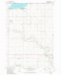
1980 Map of Seneca
USGS Topo · Published 1980About this map
The East Fork Des Moines River meanders through the heart of this northern Iowa landscape, defining the agricultural and industrial character of the region during the late 1970s. The terrain is marked by numerous active resource extraction sites, including a claypit and several Gravel Pits concentrated along the riverbanks. The small settlement of Seneca anchors the southeastern corner, while the surrounding townships of Denmark and Seneca are dotted with landmarks vital for genealogical research. Sacred sites like St Pauls Cem, Blakjer Ch, and St John Ch provide evidence of the community's early development and rural heritage. This map captures the network of drainage and local waterways, such as Black Cat Creek and Calamus Creek, which historically supported the intensive farming operations of Kossuth and Emmet counties.
Find a feature on this map
25 named features on this map. Tap any name to fly to it.
Don’t see what you’re looking for? This feature index may not catch every label — zoom into the map to look around manually.
Map Details
Editions of this 1980 Seneca Map
This is the sole edition of this map. No revisions or reprints were ever made.
Other maps of this area

1954 · Fairmont
USGS Topo · 1:250,000

1958 · Fairmont
USGS Topo · 1:250,000

1980 · Lone Rock
USGS Topo · 1:24,000

1980 · Fenton
USGS Topo · 1:24,000

1980 · Depew
USGS Topo · 1:24,000

1980 · Armstrong
USGS Topo · 1:24,000

1980 · Ringsted
USGS Topo · 1:24,000

1980 · Swea City
USGS Topo · 1:24,000

1980 · Armstrong SE
USGS Topo · 1:24,000
1980 · Dolliver
USGS Topo · 1:24,000