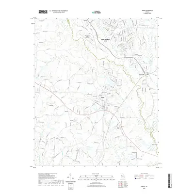
2020 Map of Senoia
USGS Topo · Published 2020About this map
Senoia and the southern reaches of Peachtree City anchor this landscape along the border of Coweta and Fayette counties. The region is defined by a series of significant water bodies and drainage basins, including the Starrs Millpond on Whitewater Creek and the meandering paths of Line Creek and Dead Oak Creek. Genealogists will find a high density of burial sites across the quadrangle, ranging from the central Senoia City Cemetery and Oak Grove Cemetery to smaller family and community plots like Deik-Nixon Cemetery and Neriah Cemetery. Aviation is a notable presence in the local economy and transport network, represented by both the Atlanta Regional Airport Falcon Field in the north and the smaller Big T Airport further south. The map documents the suburban development patterns of the early 21st century alongside established landmarks like Starrs Mill.
Find a feature on this map
208 named features on this map. Tap any name to fly to it.
Don’t see what you’re looking for? This feature index may not catch every label — zoom into the map to look around manually.
Map Details
Editions of this 2020 Senoia Map
This is the sole edition of this map. No revisions or reprints were ever made.
Other maps of this area

1953 · Atlanta
USGS Topo · 1:250,000

1957 · Atlanta
USGS Topo · 1:250,000

1958 · Atlanta
USGS Topo · 1:250,000

1965 · Tyrone
USGS Topo · 1:24,000

1965 · Fayetteville
USGS Topo · 1:24,000

1965 · Madras
USGS Topo · 1:24,000

1965 · Senoia
USGS Topo · 1:24,000

1965 · Brooks
USGS Topo · 1:24,000

1965 · Sharpsburg
USGS Topo · 1:24,000
1971 · Luthersville
USGS Topo · 1:24,000