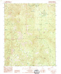
1987 Map of Sentinel Peak
USGS Topo · Published 1994About this map
Sequoia National Forest and the Tule River Indian Reservation meet in this high-elevation landscape, dominated by the massif of Slate Mountain and the prominent Sentinel Peak. The settlement of Ponderosa sits near the northern boundary, serving as a gateway to the meadows and groves that characterize this portion of the Sierra Nevada. High meadows like Quaking Aspen Meadow and Quaker Meadow are interspersed with significant sequoia stands, including the Wheel Meadow Grove, Red Hill Grove, and Peyrone Grove.
Find a feature on this map
52 named features on this map. Tap any name to fly to it.
Don’t see what you’re looking for? This feature index may not catch every label — zoom into the map to look around manually.
Map Details
Editions of this 1987 Sentinel Peak Map
2 editions found
Other maps of this area

1904 · Kaweah
USGS Topo · 1:125,000

1905 · Olancha
USGS Topo · 1:125,000

1905 · Fairview
USGS Topo · 1:24,000

1906 · Kernville
USGS Topo · 1:125,000

1907 · Olancha
USGS Topo · 1:125,000

1908 · Kernville
USGS Topo · 1:125,000

1909 · Kaweah
USGS Topo · 1:125,000

1918 · Fairview
USGS Topo · 1:31,680

1936 · Tobias Peak
USGS Topo · 1:125,000

1937 · Kaweah
USGS Topo · 1:125,000