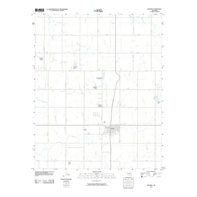
2010 Map of Sentinel
USGS Topo · Published 2010About this map
Sentinel serves as the primary hub of this Washita County landscape, where the town’s grid sits at the intersection of several county roads and State Highways 44 and 55. The surrounding area is defined by a series of North-South and East-West roads that segment the territory into regular agricultural plots. Water management is a significant feature of the terrain, visible through numerous flood control structures such as the Upper Elk Creek Site 10 Dam and Myron Straub Dam. The drainage network includes Spring Creek and the meandering Elk Creek, which flows south of the main townsite. Local history is anchored by the Sentinel Cemetery just north of town and the more isolated Huckleby Cemetery to the southwest, providing specific points of interest for genealogists tracing families in this part of Oklahoma.
Find a feature on this map
29 named features on this map. Tap any name to fly to it.
Don’t see what you’re looking for? This feature index may not catch every label — zoom into the map to look around manually.
Map Details
Editions of this 2010 Sentinel Map
This is the sole edition of this map. No revisions or reprints were ever made.
Other maps of this area

1955 · Clinton
USGS Topo · 1:250,000

1957 · Clinton
USGS Topo · 1:250,000

1957 · Dill City
USGS Topo · 1:62,500

1961 · Hobart
USGS Topo · 1:62,500

1961 · Retrop
USGS Topo · 1:62,500

1961 · Elk City
USGS Topo · 1:62,500

1976 · Dill City SE
USGS Topo · 1:24,000

1983 · Dill City
USGS Topo · 1:24,000
1983 · Dill City SE
USGS Topo · 1:24,000

1984 · Sentinel
USGS Topo · 1:24,000