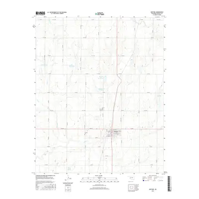
2016 Map of Sentinel
USGS Topo · Published 2016About this map
Sentinel serves as the primary hub of this Washita County landscape, organized around a rigid grid of residential and commercial streets such as E Main St, Washita St, and Grant St. The town's proximity to Elk Cr and its various tributaries defines the local geography, with the surrounding countryside dotted by numerous managed water features. These include the Upper Elk Creek Site 8 Reservoir, Upper Elk Creek Site 5 Reservoir, and Ridling Reservoir, which illustrate the region's historical reliance on water management for agriculture and local needs.
Find a feature on this map
54 named features on this map. Tap any name to fly to it.
Don’t see what you’re looking for? This feature index may not catch every label — zoom into the map to look around manually.
Map Details
Editions of this 2016 Sentinel Map
This is the sole edition of this map. No revisions or reprints were ever made.
Other maps of this area

1955 · Clinton
USGS Topo · 1:250,000

1957 · Clinton
USGS Topo · 1:250,000

1957 · Dill City
USGS Topo · 1:62,500

1961 · Hobart
USGS Topo · 1:62,500

1961 · Retrop
USGS Topo · 1:62,500

1961 · Elk City
USGS Topo · 1:62,500

1976 · Dill City SE
USGS Topo · 1:24,000

1983 · Dill City
USGS Topo · 1:24,000
1983 · Dill City SE
USGS Topo · 1:24,000

1984 · Sentinel
USGS Topo · 1:24,000