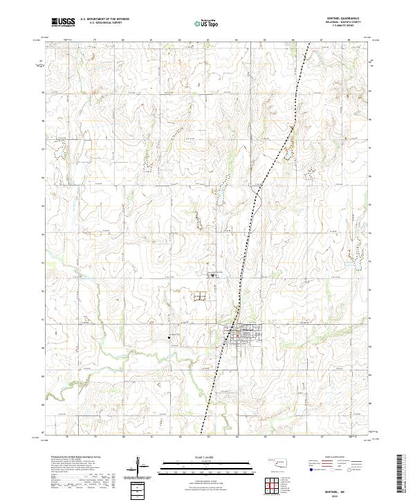
2022 Map of Sentinel
USGS Topo · Published 2022About this map
The town of Sentinel serves as the central hub for this portion of Washita County, Oklahoma, positioned at the junction of State Highway 44 and Highway 55. This 2022 survey illustrates the grid-based settlement pattern of the western plains, with the town center featuring a Post Office and a concentrated residential block system. The surrounding rural landscape is defined by the Section Land Survey System, with an extensive network of roads like e1280 RD and N/S 213 RD following square mile boundaries.
Find a feature on this map
53 named features on this map. Tap any name to fly to it.
Don’t see what you’re looking for? This feature index may not catch every label — zoom into the map to look around manually.
Map Details
Editions of this 2022 Sentinel Map
This is the sole edition of this map. No revisions or reprints were ever made.
Other maps of this area

1955 · Clinton
USGS Topo · 1:250,000

1957 · Clinton
USGS Topo · 1:250,000

1957 · Dill City
USGS Topo · 1:62,500

1961 · Hobart
USGS Topo · 1:62,500

1961 · Retrop
USGS Topo · 1:62,500

1961 · Elk City
USGS Topo · 1:62,500

1976 · Dill City SE
USGS Topo · 1:24,000

1983 · Dill City
USGS Topo · 1:24,000
1983 · Dill City SE
USGS Topo · 1:24,000

1984 · Sentinel
USGS Topo · 1:24,000