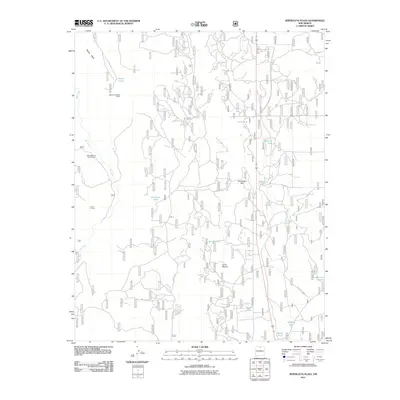
2011 Map of Servilleta Plaza
USGS Topo · Published 2011About this map
Petaca Mesa and the drainage of the Rio Tusas define this high-altitude landscape in Rio Arriba County as it appeared in the early 21st century. The map reveals a land managed for water and mineral resources, notably marked by the Blowout Number 3 Mine in the northwest. A complex network of Forest Service roads, including Forest Rd 97 and Forest Rd 2850, provides access to numerous livestock and wildlife water sources such as Petaca Tanke, Servilleta Tank, and Railroad Tank. Small residential or agricultural clusters like Riverside One Through Four and Laura Crystal appear near the river, while prominent landforms like Cerro Mojino and the Comanche Rim overlook the varied terrain. This survey reflects the modern intersection of traditional ranching infrastructure and forest management in northern New Mexico.
Find a feature on this map
20 named features on this map. Tap any name to fly to it.
Don’t see what you’re looking for? This feature index may not catch every label — zoom into the map to look around manually.
Map Details
Editions of this 2011 Servilleta Plaza Map
This is the sole edition of this map. No revisions or reprints were ever made.
Other maps of this area

1918 · Abiquiu
USGS Topo · 1:125,000

1918 · Tusas
USGS Topo · 1:125,000

1953 · La Madera
USGS Topo · 1:24,000

1953 · Ojo Caliente
USGS Topo · 1:24,000

1954 · Raton
USGS Topo · 1:250,000

1954 · Aztec
USGS Topo · 1:250,000

1958 · Raton
USGS Topo · 1:250,000

1958 · Aztec
USGS Topo · 1:250,000

1960 · Taos Junction
USGS Topo · 1:24,000

1961 · Carson
USGS Topo · 1:24,000