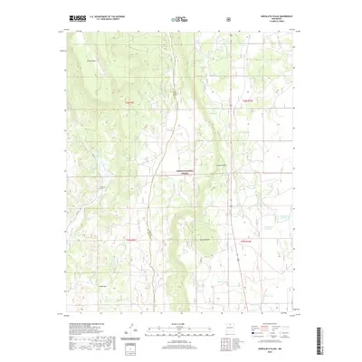
2020 Map of Servilleta Plaza
USGS Topo · Published 2020About this map
Servilleta Plaza and the scattered settlement of Cañon Seco anchor this high-elevation landscape within the Carson National Forest. The topography is dominated by dramatic basaltic features and deep valleys, most notably the high Petaca Mesa to the northwest and the prominent Cerro Mojino peak. The perennial waters of the Rio Tusas cut through the western half of the quadrangle, while the arid eastern stretches are defined by the Comanche Rim. A network of localized water sources, including Railroad Tank, Soloman Tank Number Two, and Bailey Tank Number 2, suggests a land managed for livestock and seasonal grazing. This 2020 survey provides a clear view of the rural infrastructure in Rio Arriba County, where forest roads like Fdr 376 provide the primary access to the rugged interior.
Find a feature on this map
25 named features on this map. Tap any name to fly to it.
Don’t see what you’re looking for? This feature index may not catch every label — zoom into the map to look around manually.
Map Details
Editions of this 2020 Servilleta Plaza Map
This is the sole edition of this map. No revisions or reprints were ever made.
Other maps of this area

1918 · Abiquiu
USGS Topo · 1:125,000

1918 · Tusas
USGS Topo · 1:125,000

1953 · La Madera
USGS Topo · 1:24,000

1953 · Ojo Caliente
USGS Topo · 1:24,000

1954 · Raton
USGS Topo · 1:250,000

1954 · Aztec
USGS Topo · 1:250,000

1958 · Raton
USGS Topo · 1:250,000

1958 · Aztec
USGS Topo · 1:250,000

1960 · Taos Junction
USGS Topo · 1:24,000

1961 · Carson
USGS Topo · 1:24,000