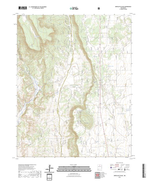
2023 Map of Servilleta Plaza
USGS Topo · Published 2023About this map
Carson National Forest spans much of this high-altitude landscape, where the boundary between Rio Arriba Co and Taos Co cuts through a series of dramatic volcanic and erosional features. The terrain is defined by the prominent heights of Petaca Mesa and the sharp edge of Comanche Rim, while Cerro Mojino stands as a distinct landmark in the southern reaches. This modern survey illustrates a water-focused landscape essential for ranching and forest management, marked by numerous named livestock and catchment points such as Soloman Tank Number Two, Bailey Tank Number 2, and the curiously named Railroad Tank. The drainage of Rio Tusas and the winding Cañon Seco provide the primary hydrological structure for this region of northern New Mexico, which remains sparsely developed and largely dedicated to public forest lands.
Find a feature on this map
24 named features on this map. Tap any name to fly to it.
Don’t see what you’re looking for? This feature index may not catch every label — zoom into the map to look around manually.
Map Details
Editions of this 2023 Servilleta Plaza Map
This is the sole edition of this map. No revisions or reprints were ever made.
Other maps of this area

1918 · Abiquiu
USGS Topo · 1:125,000

1918 · Tusas
USGS Topo · 1:125,000

1953 · La Madera
USGS Topo · 1:24,000

1953 · Ojo Caliente
USGS Topo · 1:24,000

1954 · Raton
USGS Topo · 1:250,000

1954 · Aztec
USGS Topo · 1:250,000

1958 · Raton
USGS Topo · 1:250,000

1958 · Aztec
USGS Topo · 1:250,000

1960 · Taos Junction
USGS Topo · 1:24,000

1961 · Carson
USGS Topo · 1:24,000