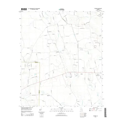
2014 Map of Sessoms
USGS Topo · Published 2014About this map
Guysie and Sessoms anchor the rural landscape of this Bacon County region, where the terrain is defined by the branching waters of Little Hurricane Creek and Brushy Creek. The settlement pattern is deeply rooted in local lineage, evidenced by a dense network of family-named cemeteries and landmarks such as Stewart Cemetery, Meeks Cemetery, and Mercer Cemetery. In the southeast, the Bacon County Airport stands as a modern focal point near Mullis Lake, while the western edge is marked by the border of Coffee County. Many of the local roads, such as Old Dixie School Rd and Campground Church Rd, reflect the historic community centers of the area. This 2014 survey documents the enduring agricultural character of the Georgia coastal plain, where quiet water bodies like Whiddons Millpond and Bryant and Futch Lake punctuate the timberlands and farm plots.
Find a feature on this map
121 named features on this map. Tap any name to fly to it.
Don’t see what you’re looking for? This feature index may not catch every label — zoom into the map to look around manually.
Map Details
Editions of this 2014 Sessoms Map
This is the sole edition of this map. No revisions or reprints were ever made.
Other maps of this area

1953 · Waycross
USGS Topo · 1:250,000

1958 · Waycross
USGS Topo · 1:250,000

1971 · Nicholls NE
USGS Topo · 1:24,000

1971 · Nicholls
USGS Topo · 1:24,000

1971 · Wilsonville
USGS Topo · 1:24,000

1971 · Alma NW
USGS Topo · 1:24,000

1971 · Beach
USGS Topo · 1:24,000

1971 · Alma
USGS Topo · 1:24,000

1971 · Sessoms
USGS Topo · 1:24,000

1971 · Denton
USGS Topo · 1:24,000